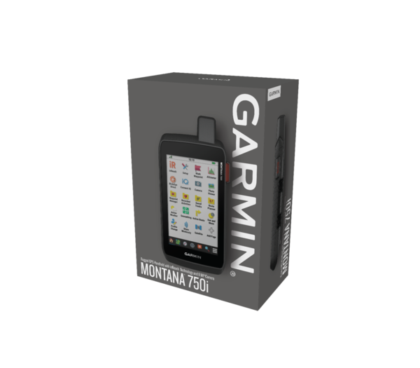
Garmin Montana 750i incl. CityNavigator Europe + TopoActive
- approx. 21-35 days delivery time
Identical to Montana 700i with additional
Robust outdoor navigation device with touchscreen and inReach® technology
The Montana 700i supports GPS and GLONASS satellite systems and is equipped with inReach technology, which allows two-way communication.
in-reach technology
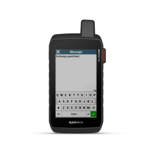
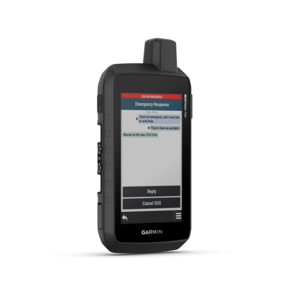
Equipped with inReach satellite technology, you can Messages to friends and receive and send relatives from the most remote corners of the world - even without cell phone reception. The satellite network means you are independent of dead spots or poor reception.
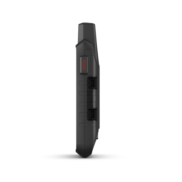
In emergencies you can get help from anywhere in the world SOS button request. This establishes a connection to the GEOS rescue control center, which can be reached day and night, every day of the year. You can use text communication to give precise information about what is happening and also receive instructions yourself.
Note : A paid Garmin satellite subscription is required to use InReach technology over the global Iridium satellite network!
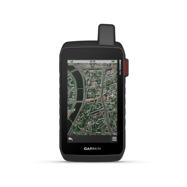
Robust navigation device with pre-installed map
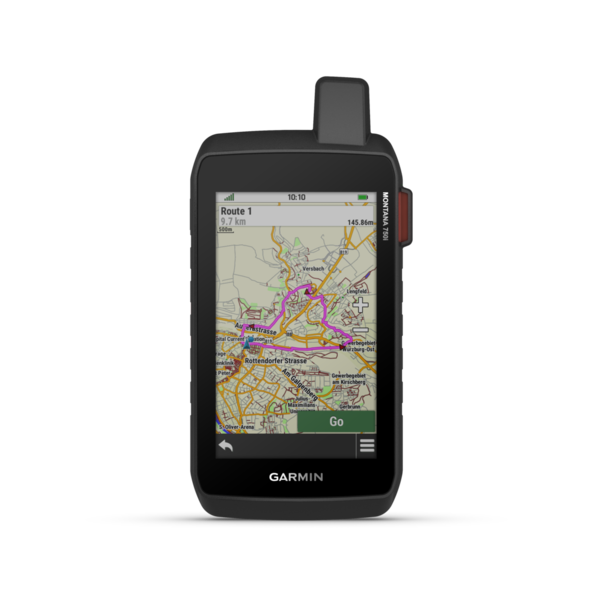
So that you can start your adventure straight away, there is already the Routable TopoActive map of Europe on the device. This makes routing by bike, car and on foot particularly easy. One too Flatly With individually adjustable distance, you can plan with the device if you want to get to know completely new corners in your area.
In addition to the TopoActive map of Europe there is also the CityNavigator map installed, which allows you to navigate to addresses and POIs.
Thanks to the robust housing, the device withstands wind and weather and is waterproof according to IPX7 . The battery life in GPS mode is up to 18 hours, and in expedition mode even up to 2 weeks.
Thanks to Wi-Fi, Bluetooth and Ant+ connectivity, you can also pair the Montana with your smartphone and sensors. This is how you get e.g. B. Weather data or you can design and configure your new GPS according to your own wishes.
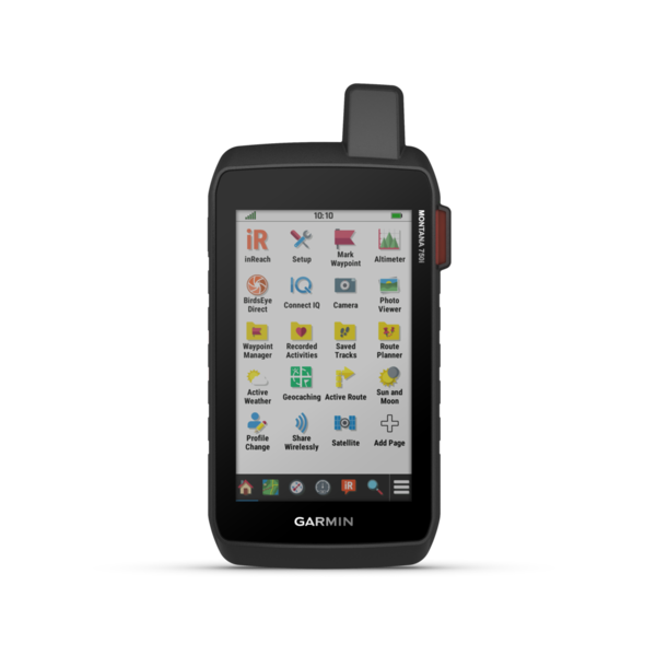
Functional overview of the Montana 700i
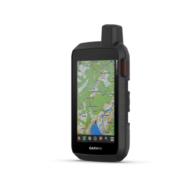
Robust design
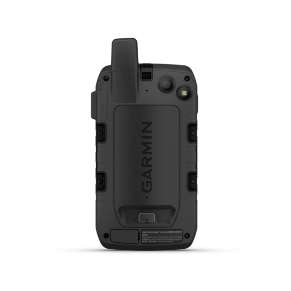
Robust design tested to military standards with a 5" touch display for best operation and readability - in portrait and landscape format.
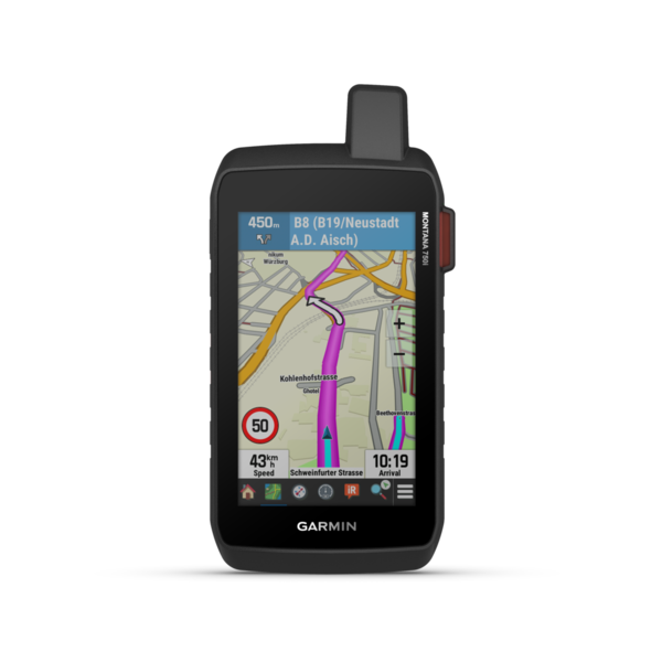
TopoActive Europe map
No matter what adventure you have planned - the Montana series will navigate you anywhere thanks to the pre-installed TopoActive Europe map.
Multi-GNSS
Thanks to the support of GPS and Galileo and GLONASS, your position is determined precisely even in remote areas.
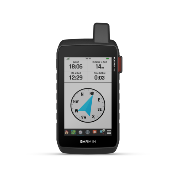
ABC sensors
The barometric altimeter provides consistent altitude calculations, while the 3-axis compass always shows you the right direction.
Round trip routing
Thanks to RoundTrip Routing, create a circular route based on an individual distance or any starting point.
Expedition mode
In expedition mode, your Montana's battery lasts up to 2 weeks - so nothing stands in the way of your adventure.
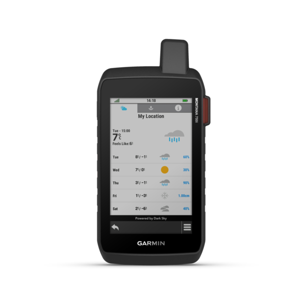
Active Weather
Coupled with your smartphone, the Montana series informs you in real time about the current weather data. This means you will no longer be surprised by any changes in the weather.
Garmin Explore
Plan your waypoints, routes and activities easily in the Garmin Explore app/website and upload them directly to the device.
Connectivity
Customize your device with Connect IQ or use smart features such as LiveTrack thanks to the ANT+/WLAN and Bluetooth connectivity.
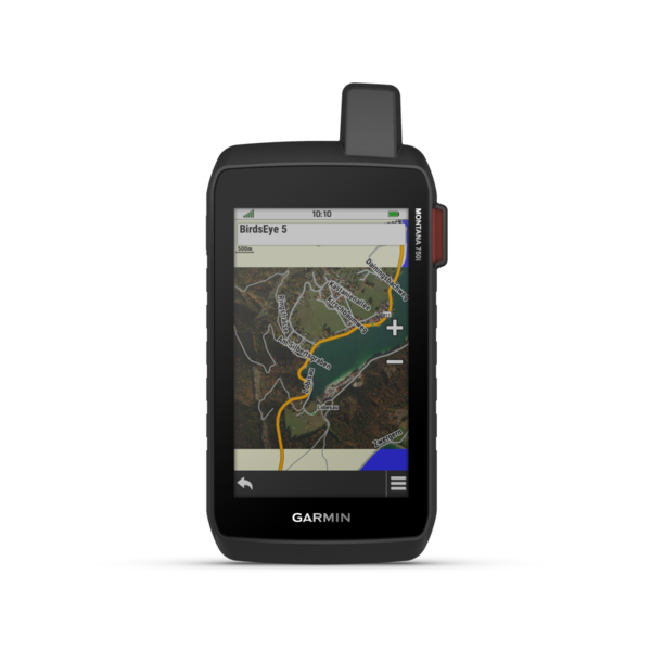
Birdseye satellite images
High-resolution, photorealistic BirdsEye satellite images - directly on your device. Discover new trails, create waypoints and more.
Two-way communication
Write and receive messages using inReach technology across the global Iridium satellite network. You can be reached worldwide, even without a mobile network.
Internal SOS emergency call
In an emergency, trigger an SOS emergency call. You are connected to the global search and rescue control center GEOS at any time via direct communication and an emergency button.
Live tracking
Thanks to 100% global Iridium satellite coverage, you can share your location from anywhere and let friends join your tour via LiveTrack.
inReach weather
Thanks to the inReach weather, the Montana 700i provides you with regular weather forecasts - regardless of your smartphone.
Citynavigator maps
From the trail to the street: The pre-installed CityNavigator maps also navigate you to any address, intersection, POI, etc. - free map updates included!
Note : A paid Garmin satellite subscription is required to use InReach technology over the global Iridium satellite network!
Some jurisdictions regulate or prohibit the use of satellite communications devices. It is your responsibility to know and obey all applicable laws in the jurisdictions where the device is to be used.